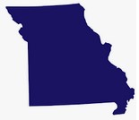
- Missouri Fast Facts -
(Temporary) Missouri Archivist : The Territory of Missouri was part of the 1803 Louisiana Purchase which consisted of most of the land in the
Mississipi River's drainage basin west of the river. The Missouri Territory was decreased in size on June 4, 1812, when
Louisiana was admitted to the Union, and further decreased in 1821 when the Territory of Arkansas was created from a
southeastern portion. The State of Missouri was admitted to the Union as the 24th state on 10 August, 1821, as a slave
state as part of the Missouri Compromise of 1820. The map here
shows the how the Louisiana Purchase was divided into other territories and, eventually, states. (link opens a new window)
Today Missouri covers 68,686 square miles of land divided into 114 counties and ranks 30th in population. The State Capitol is Jefferson City and the largest city is Kansas City. It is bordered on the north by Iowa, east by Iowa, the south by Arkansas, the east by Illinois, Kentucky and Tennessee and on the west by Nebraska.
Missouri has no official state nickname however its unofficial nickname is the "Show Me State."
The genealogical records held here are for use by the general public. These records have been submitted to the USGenNet Data Repository by volunteers and researchers just like you for permanent on-line free-access.


